

Posts with tag 'Central Oregon Hikes'
Subscribe and receive email notifications of new blog posts.
 RSS Feed
4
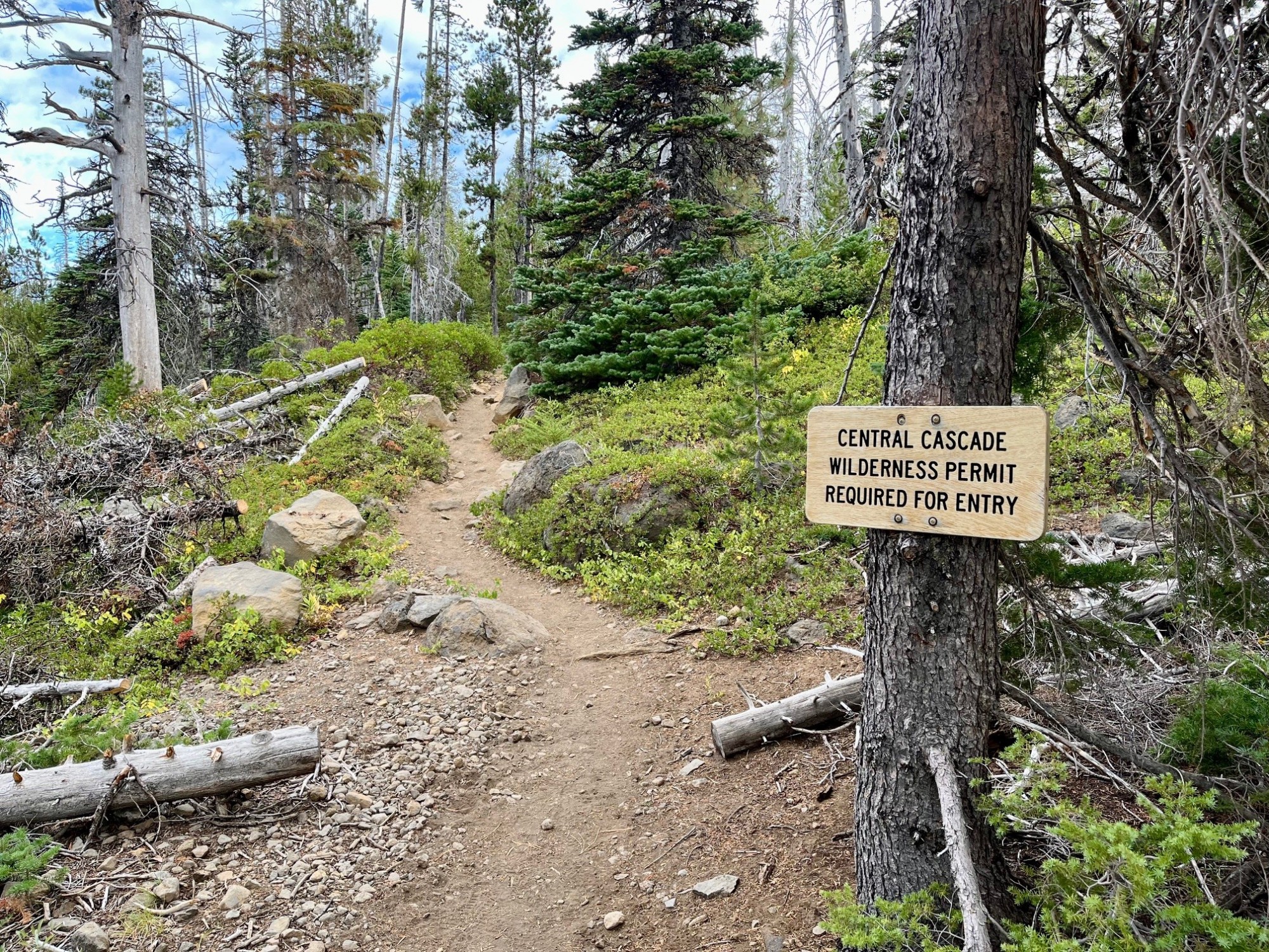
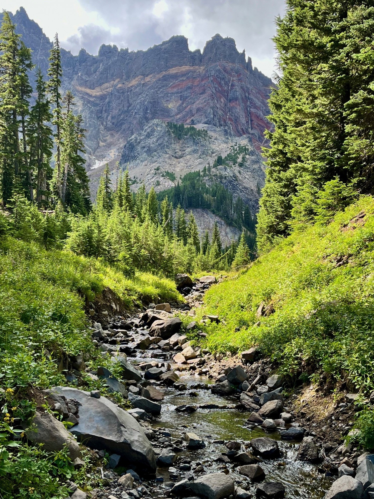
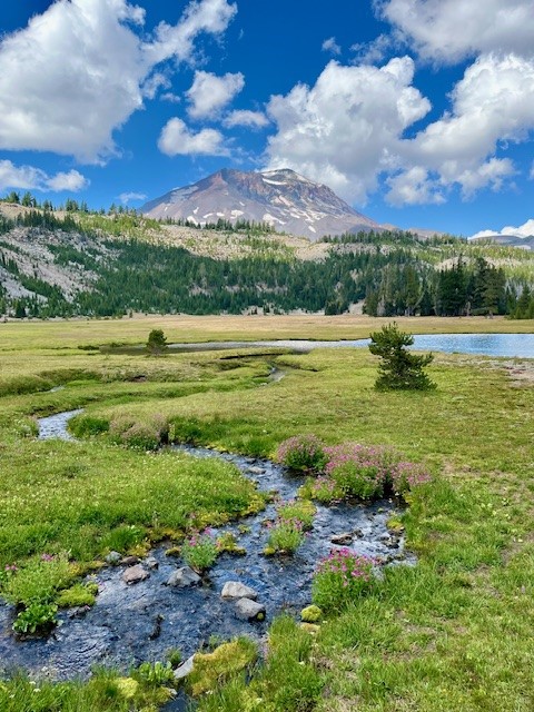
Canyon Meadow Hike is a Great Way to Explore Three Fingered Jack
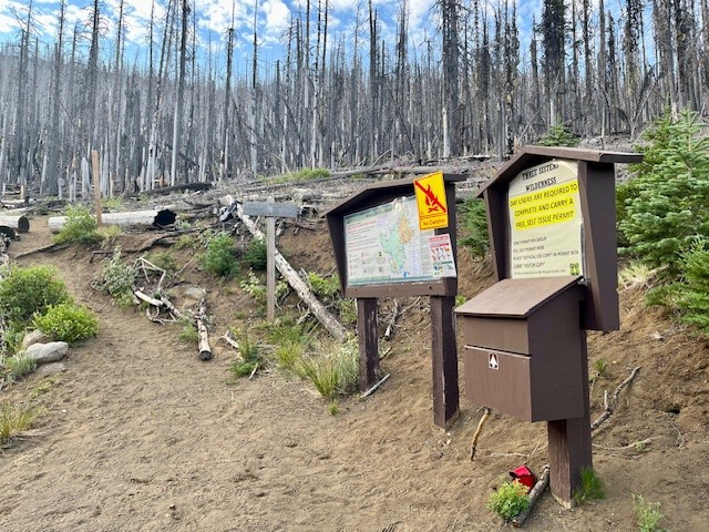
Canyon Meadow is a Permitted Hike in the Mt Jefferson Wilderness
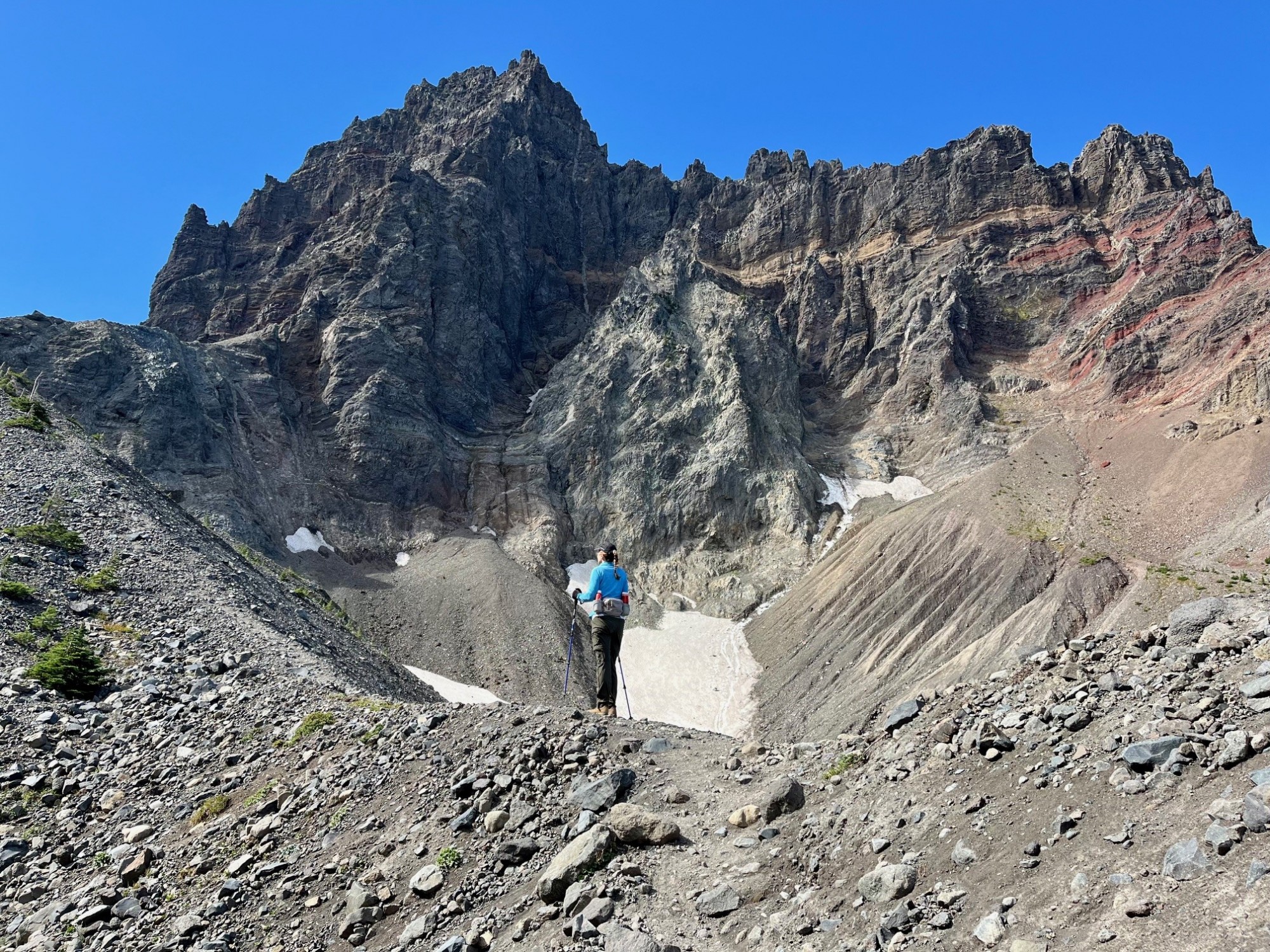
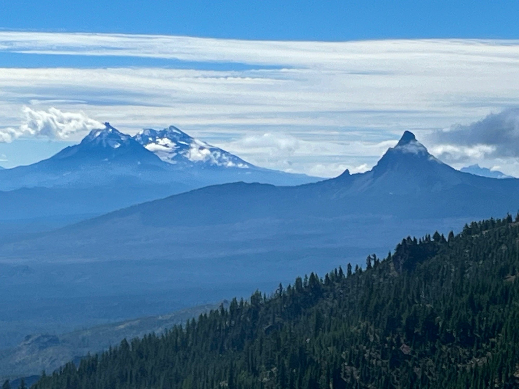
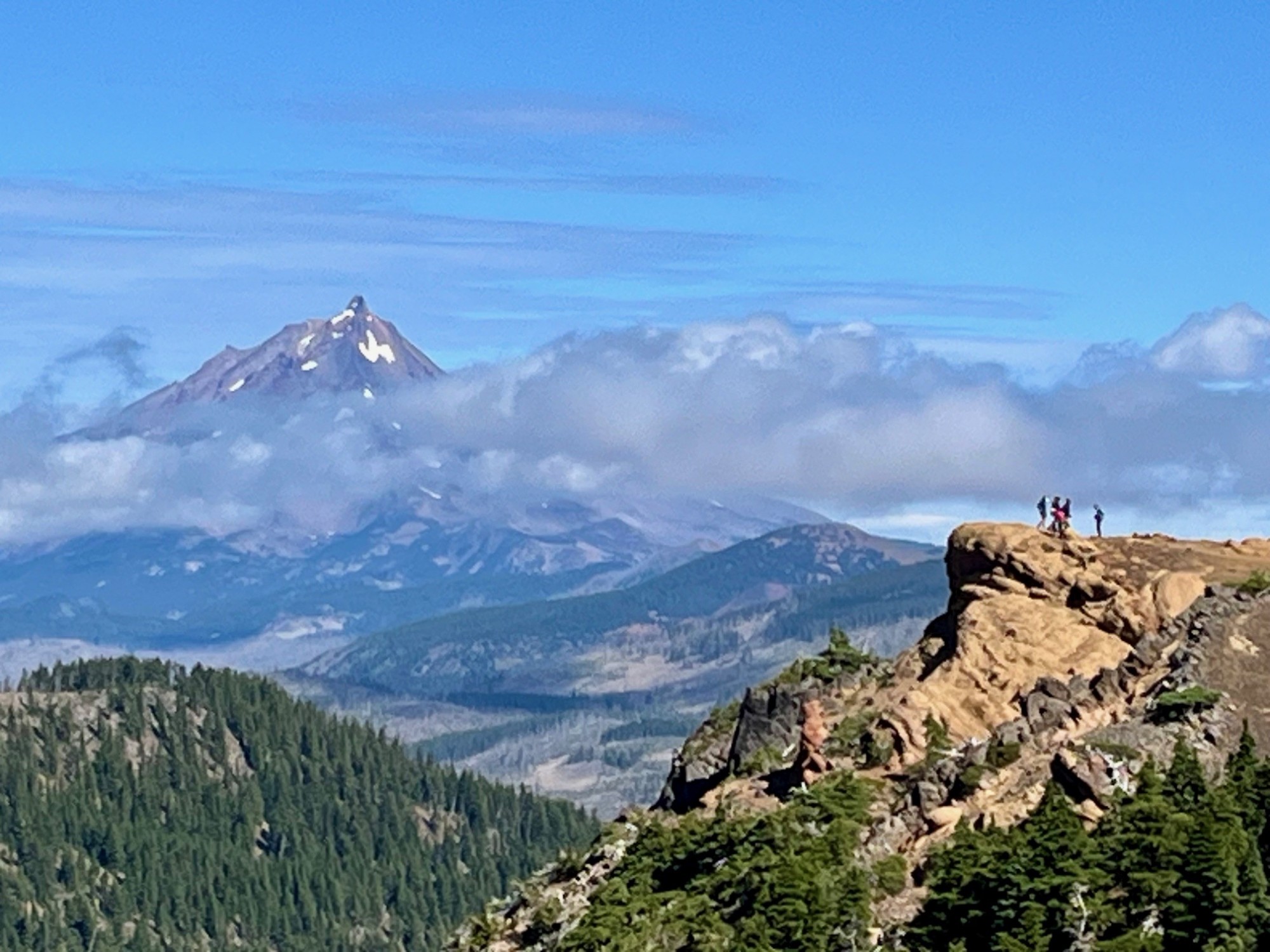
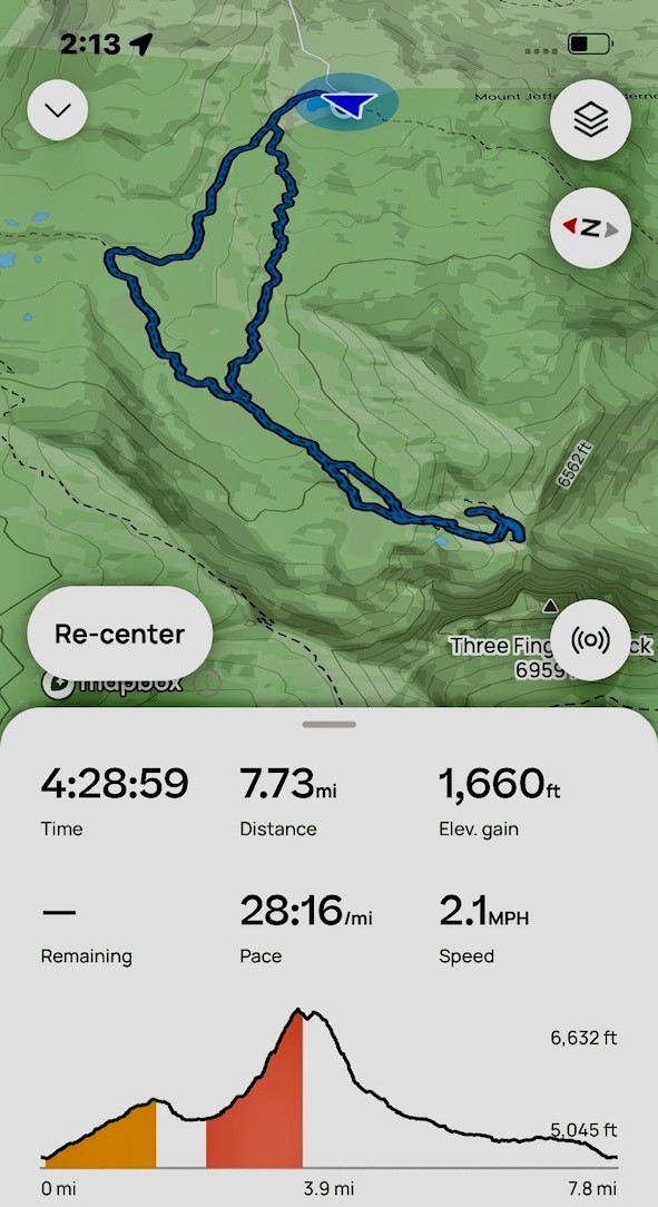
Canyon Meadow is a relatively easy hike in Central Oregon if limited to just the meadow loop which takes trekkers through burned forest, old growth forest and the meadow back to the beginning at Jack Lake. However, many will take the one way climb past the meadow up to the base of Three Fingered Jack. This adds significant elevation gain as well as beautiful views of Three Fingered Jack, sometimes including mountain goats and technical climbers on the craggy top of the mountain. For those adventurous enough to climb the loose rock and pumice past the glacial lake onto the ridge separating Three Fingered Jack from the nearby unnamed hill, the views south toward the Three Sisters and Mt. Washington and the views north toward Mt. Jefferson are spectacular.
 |
 |
 |
 |
Scrambling down the loose scree from the view points takes time, and trekking poles can be very helpful. Once the difficult section of the hike is passed, people can return the way they had come, or for a difference experience they can hike down the meadow following the stream that flows from the moraine holding the glacial lake. During certain times of the year, this path can be through acres of lupine dominated wildflowers. For those who take the entire Canyon Meadow loop as suggested, the trip results in over 1600 feet of elevation gain and under eight miles in length.
 |
 |
12
Bend Premier Real Estate | September 2024 Newsletter
What's in the September 2024 Bend Premier Real Estate Newsletter?
- Are Lower Mortgage Rates Spurring Bend Sales?
- Summertime Fruit Salad
- 10 Things to Do in September
- Take the Climbers Trail to Middle Sister
- Early Forecasts for the 2025 Housing Market
21
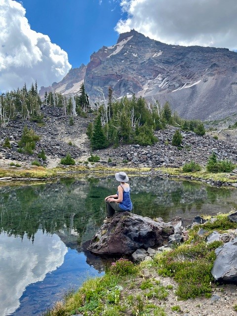
Golden Lake is a Hidden Treasure in the Three Sisters Wilderness
Golden Lake is Not an Easy Hike
For Central Oregon residents and visitors looking for a great day hike, there are a good number of options available. For many, a hike of 2 to 4 miles to an amazing destination followed by the same distance back can create a full day with time to relax and enjoy both the original destination and the time back home. However, for those wishing to see more in the Cascade forests besides what is seen in a day hike, many will backpack and spend more time enjoying the destination before venturing further or coming back.
Golden Lake is one of those rarely seen destinations. It can be accessed through multiple approaches. These include the popular Green Lakes Trail in which hikers walk past the northern most Green Lake and travel above the valley to the pass between South Sister and Broken Top and then down the path that leads to Park Meadow, making sure they take the unmarked trail off this path and hike the half mile to Golden Lake. Another approach is from Three Creeks Lake, taking the Park Meadow trail and hiking through and past Park Meadow towards Green Lakes and then taking the unmarked trail to Golden Lake. Both approaches are over seven miles one direction, but the approach from Three Creeks Lake is a little shorter.
Hikers coming from Three Creeks Lake are required to walk through four miles of burned forest, the result of the Milli Fire seven years ago. There is beauty, however, in the recovering forest with many wildflowers and young trees growing back. Past the burned area, hikers enter forest before they reach Park Meadow, which was untouched by fire and a place many backpackers will spend the night. The trail steepens past park Meadow and after another mile and a half, the turn off to Golden Lake is reached.
 |
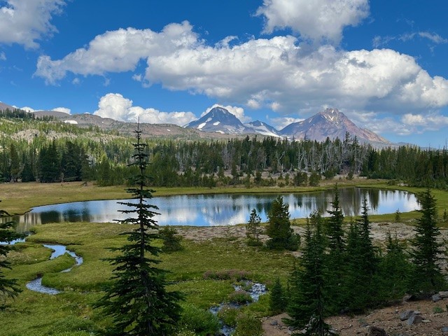 |
The name for Golden Lake is obvious during certain times of the year when yellow wildflowers are blooming in the meadow that surrounds the lake. The lake itself can reflect Broken Top, South, Middle and North Sisters on calm days. The setting is serene and lovely with very few people around.
However, one of the most special things about Golden Lake is the small stream which flows into the western side of the lake. Besides the numerous wildflowers growing on each side of the stream, people who take the time to hike the mile up that stream reach an isolated area that very few people ever visit. That last mile is steep, but the cascading stream with its wildflowers and ever changing views of the Three Sisters are amazing. At the end of the stream is a moraine which contains two springs which form the stream. People who scramble up the moraine will reach an isolated tarn lake and past that, another moraine and a second tarn lake even more special than the first. This second lake has phenomenal reflections and views of Broken Top. For those who are able to travel the entire distance, the reward can be some of the most breathtaking natural sights in Central Oregon. It is truly an exceptional place.
For those having enough energy to do the entire hike in a day starting from and returning to Three Creeks Lake, plan on sixteen miles (eight in the burned forest) and over 2000 feet of elevation gain.
 |
 |
14
Black Crater is More About the Destination Than the Journey
Black Crater Trailhead is Located off McKenzie Hwy 242
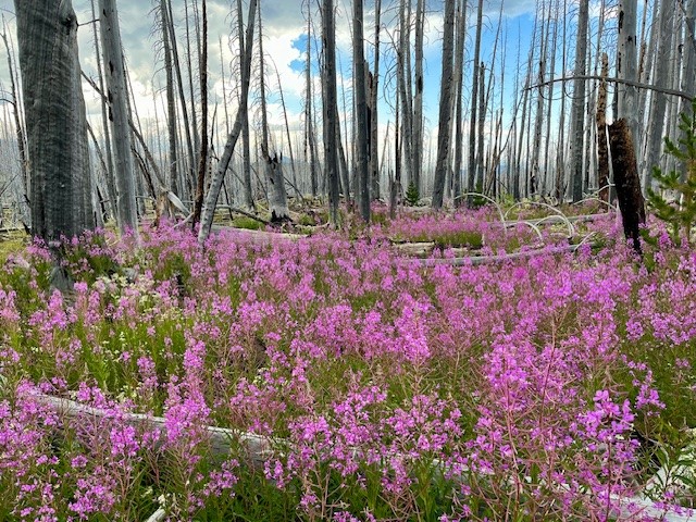
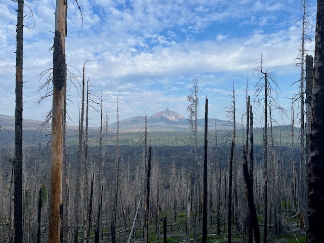
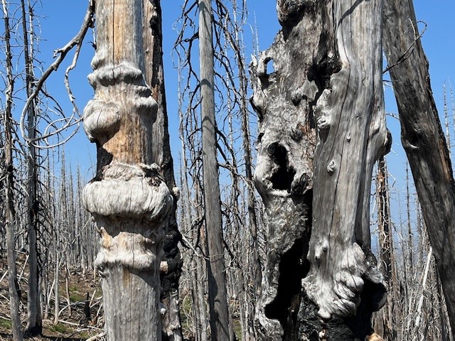
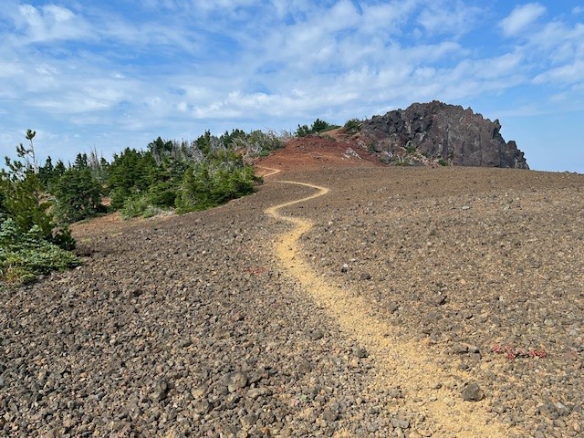
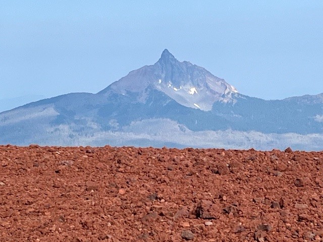
For those wanting a relatively short hike which provides for a lot of elevation gain, Black Crater is one of the best. Located off McKenzie Hwy 242, the hike is limited to the summer season when McKenzie Hwy opens each year. Unfortunately, the 2017 Milli fire burned a lot of the forest on McKenzie Hwy, and the lower slopes of Black Crater were impacted. In the seven years since the Milli fire, manzanita, certain grasses, some wildflowers, and young trees have begun to grow in the dead landscape, but it will take decades until the cinder cone is entirely forested again. The one advantage of the burned forest is the views toward Mt. Washington are far more visible in the lower elevations than they would have been eight years ago.
 |
 |
 |
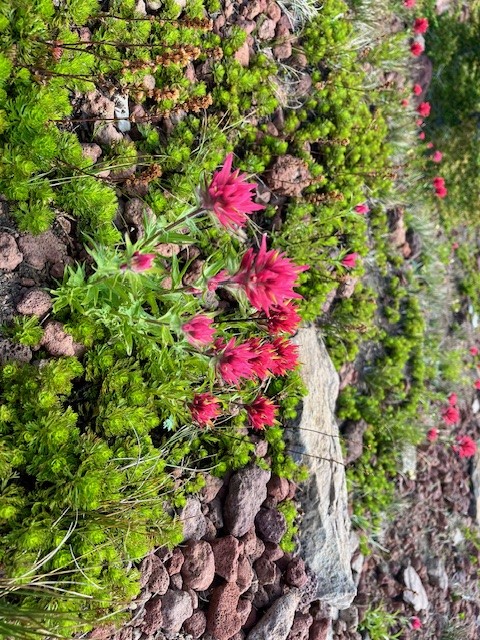 |
Roughly two and a half miles into the hike, the burned forest is left and the steep path zigzags through mixed forest and cinder fields. And at three and a half miles, hikers reach the top. The views on a clear day towards The Three Sisters, Broken Top, Mt Jefferson, Mt Washington, and all the hills in McKenzie Pass are fabulous. Plus hikers have the satisfaction of having climbed over 2300 feet to reach the top. The hike down goes faster than the up and many can complete the entire hike, without really pushing, in a little over three hours.
 |
 |
1
Hike Cooper Spur on Mt Hood for a Unique Experience
Cooper Spur is the Highest Maintained Trail on Mt Hood
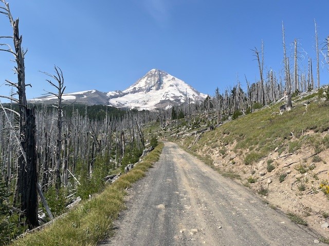
When smoke from forest fires makes hiking in Central Oregon unsafe, one option can be to go north towards Mt Hood. There are times in which air quality is hazardous in Central Oregon and the air is clear in the north part of the state. This was the situation on July 27th. It is a bit of a drive from Bend to Mt Hood (plan on 2.5 hours), but the air was clear mid morning in the Mt. Hood National Forest.
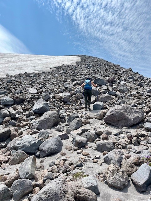
Cooper Spur is located on the northeast flank of Mt. Hood and has multiple ways to hike to it. The hike from the Cooper Spur Trailhead is one of the shorter ways, but it does gain almost 2700 feet of elevation in roughly 3 miles so it is considered a more challenging hike. To access the this trailhead, hikers drive on close to 9 miles of gravel road which has sections of bad potholes and steep drop offs at the end, but it is passable.
 |
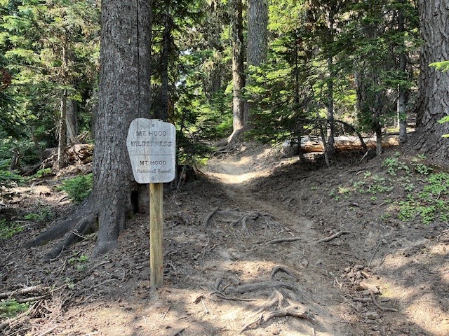 |
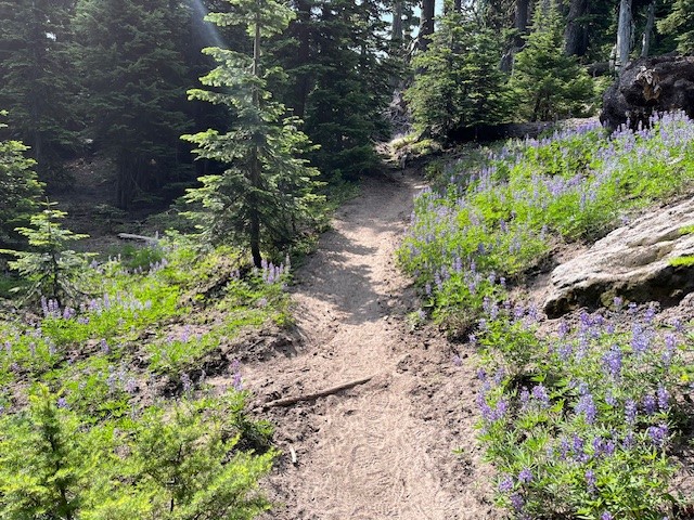
The initial hike takes trekkers through an old growth mountain hemlock forest complete with wildflowers and streams. As hikers climb, they eventually leave the forest and the path takes them through the tumbled rock of the lower sections of the Eliot Glacier moraine. After hiking above this area, hikers find themselves on the windswept, rocky plane under Cooper Spur. A 70 year old rock shelter is located here, the last one of several that once encircled Mt. Hood and acted as resting places for those who attempted the 41 mile Timberline Trail that still attracts many backpackers today. It is amazing to see this shelter still standing, given all the huge boulders that are nearby, the results of numerous avalanches.
 |
 |
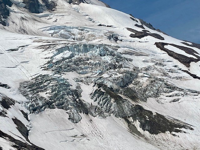
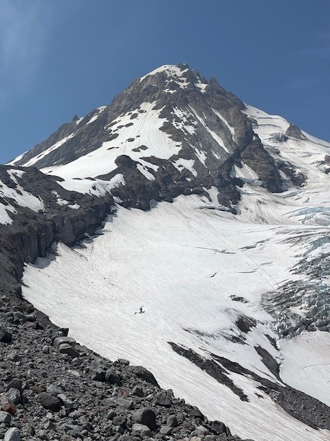
Past the stone shelter, the trail passes through rocky landscape until the actual push up the lower sections of Cooper Spur begins. Switchbacks take hikers up the spur, but near the top a snow field (this was July 27, 2024) creates a barrier that makes summiting the spur challenging. Those who wish to make it to the top need to boulder along the ridge overlooking Eliot Glacier until they reach the summit.
 |
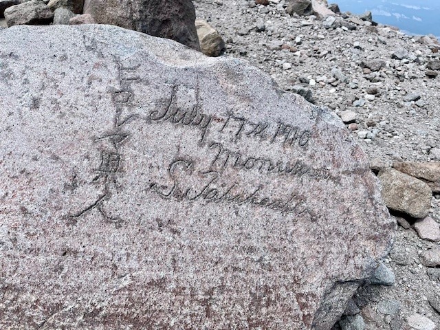 |
Once hikers reach the top of the spur, the views toward the summit are amazing as would be views toward Central Oregon and the Columbia Basin on a clear day. There is a monument stone carved in 1910 from a Japanese hiking party that is interesting to see. If hikers take a quiet break on the summit, they can hear the breaking (calving) of Eliot Glacier as it moves and thaws in the summer heat.
 |
 |
Privacy Policy / DMCA Notice / ADA Accessibility